Sha Lo Tung Management Agreement

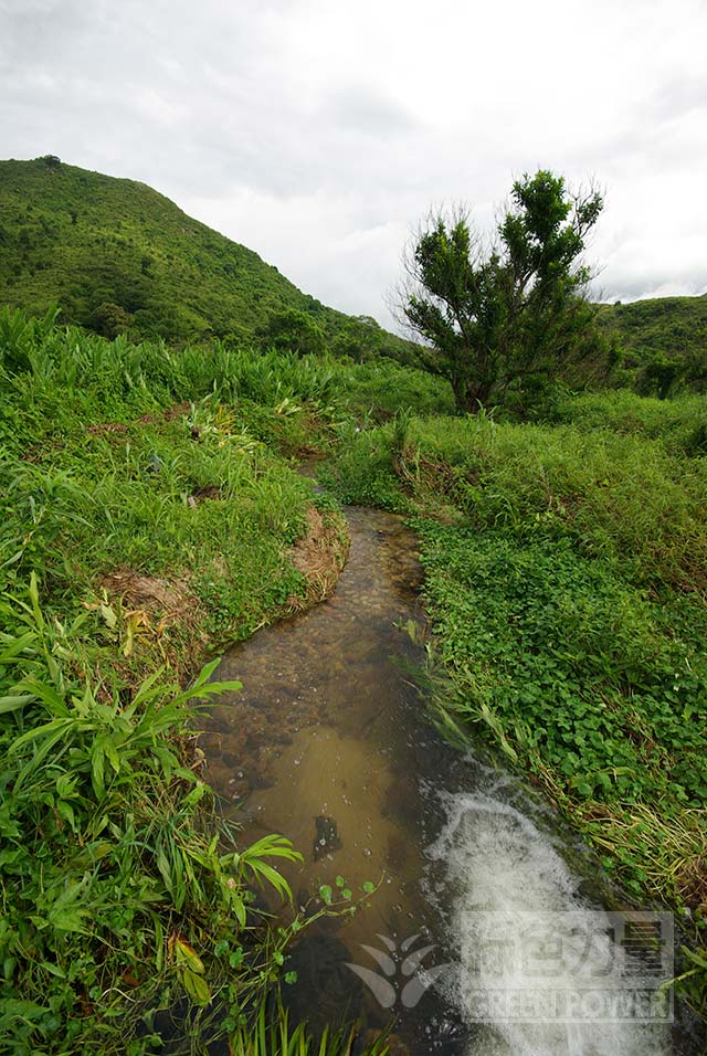
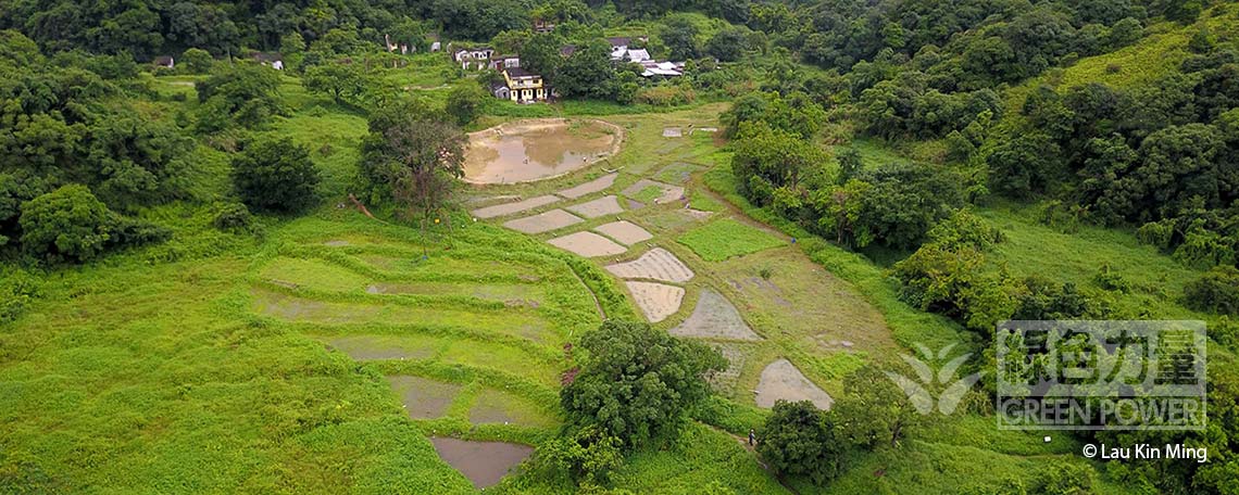
For hundreds of years, Sha Lo Tung was an ecologically rich area with lush green hills, clear streams, extensive terraced fields and farmlands. But since the 1970s, when a large number of villagers left and abandoned their farmlands – and especially in the last 20 years, the environment was repeatedly damaged, leaving Sha Lo Tung to become dried wetland and hectares of weeds. In 2017, the government agreed to “non-in-situ land exchange” to repossess the private lands at Sha Lo Tung.

As it will take time to implement the “non-in-situ land exchange”, The Environment and Conservation Fund approved the Management Agreement, “Habitat and Biodiversity Conservation Scheme in Sha Lo Tung” to speed up ecological recovery of Sha Lo Tung. Since 2020, the Management Agreement in Sha Lo Tung has been supported by the Countryside Conservation Funding Scheme. Green Power is responsible for the rehabilitation work - starting a new chapter in the conservation of Sha Lo Tung.


Rebuilding Wetland Restoring Ecology

Sha Lo Tung covers an area of 55 hectares, 11.45 of which are included in the Management Agreement. This area includes private lands surrounding Cheung Uk and Lee Uk, and there are several habitats – marshes, abandoned farmlands, woodlands, rivers, etc. Parts of the area are still pristine, while others have lost their ecological functions due to abandonment and anthropogenic damage.

Through various reconstruction efforts, we aim to restore the past ecological richness of Hong Kong’s rare valley wetland:

  • Retrace and rehabilitate historic irrigation facilities, in order to almost replicate the old stream water irrigation system to reconstruct wetland;
  • Construct an “eco-pond” to create another water body for the gradually drying out Sha Lo Tung, while creating suitable habitats for dragonflies, freshwater fish and amphibians;
  • Construct “artificial marshes” by soil reprofiling, then filling them with water and planting aquatic plants to further increase the wetland area;
  • Work with villagers to reintroduce agriculture in order to restore ecosystems and foster the local agriculture industry;
  • Carry out a series of ecological baseline surveys to obtain ecological data on dragonflies, freshwater fish, reptiles and amphibians, mammals, butterflies and plants;
  • Create the first habitat map for Sha Lo Tung, using drone technology to photograph the whole Sha Lo Tung basin, drawing an aerial map for the ecosystems; and
  • Promote conservation by citizens through a series of community and educational activities, and encourage members of the public to learn the history and ecology of Sha Lo Tung and participate in conservation work.
Ecology - Explore the Brilliant Biodiversity


Video


[Time-lapse] Construct Eco-pond and Artificial Marshes in Sha Lo Tung
Night and Day of Sha Lo Tung – Part 1
Night and Day of Sha Lo Tung – Part 2

Contact us

Tel.: 3961 0200
Fax.: 2314 2661
Email:slt@greenpower.org.hk
Address: Rm. 607, 6/F, Cheung Sha Wan Plaza Tower I, No. 833 Cheung Sha Wan Road, Kowloon (Lai Chi Kok MTR Exit A)

Any opinions, findings, conclusions or recommendations expressed in this website do not necessarily reflect the views of the Government of the Hong Kong Special Administrative Region and the Advisory Committee on Countryside Conservation.